Lorna Doone Walks | reliving a famous novel |


| Select Your Walk | Walk 1 (2.6 miles) | Walk 2 (4.8 miles) | Walk 3 (4.2 miles) |
| to Oare | Bagworthy Waters & Medieval Village | to Brendon |
Three delightful Exmoor walks from Malmsmead exploring the legend of Lorna Doone
There is no pub at Malmsmead.
Nearest pub :Pub at Brendon Staghunters Inn
| What to explore? |
- Lorna Doone Farm
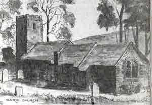
- St Mary's Church, Oare
- Blackmore Memorial
- Waterslide
- Gift Shop : Lorna Doone Farm
| Malmsmead Pay & Display | |
| SATNAV Postcode:EX35 6NU |
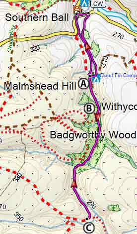
Walk 1 to Oare (2.6 miles)
Difficulty ![]()
This is a pleasant short & easy walk through part of the countryside which inspired R.D. Blackmore to write Lorna Doone.
It follows quiet lanes,tracks and foot paths.
The Walk
A At Oare's St Mary Church , Blackmore's Carver Doone shot Lorna during the wedding ceremony with John Ridd.
Blackmore based Lorna Doone on many of the tales he heard from his father who at one time was rector of Oare Church.
| Walks near Malmsmead | |
| Porlock & Porlock Weir | |
 |
Porlock and Porlock Weir, a quiet little harbour nearby, are both popular tourist attractions. |
| Lynmouth | |
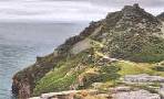 |
Of the many spectacular coastal walks in Britain,this must rank as one of the top 5 walks! |
| Hunters Inn | |
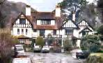 |
Hunter's Inn , a walker's favourite pub, lies secluded in the river Heddon valley. |
| Dunster | |
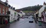 |
The historic & picturesque village of Dunster on the edge of Exmoor & the Quantocks makes an ideal centre for walkers. |
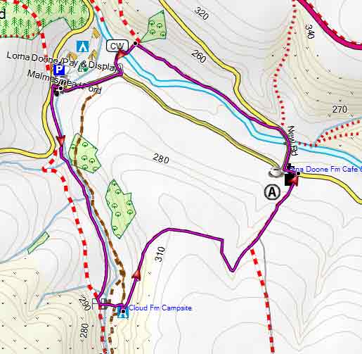
Map of Walk 1
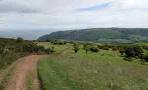
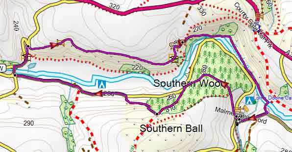
Walk 2 Bagworthy Waters & Medieval Village (4.8 miles)
Difficulty ![]()
Explore Doone Valley to the full following this very popular walk.
Please note : route offers very little shelter against heavy rain.
The Walk
A Blackmore Memorial
B Bagworthy Waters
'We knew that it brought a good stream down, as full of fish as of pebbles; and we thought that it must be very pretty to make a way where no way was, nor even a bullock came down to drink.'
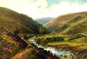
'and yet it was a frightful thing, to venture, where no grown man durst, up the Bagworthy water.'
C Unfortunately , the village ruins are now completely covered by vegetation.
main roads | 0 % |
2% | |
altitude range | 72 - 82 m |
quality of track | *** |

Download Route
| Download GPX | Mobile or GPS | |
| Download FIT | Watches | |
| Google Earth | ||
Map of Walk 2
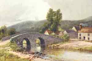
Walk 3 to Brendon (4.2 miles)
Difficulty ![]()
A delightful pub walk from Malmsmead to Brendon following mainly foot & bridle paths.
After heavy rain some stretches can be muddy.
After Brendon, you join the Coleridge Way, a long distance hiking route named after the poet Sam Coleridge.
![]() Pub at Brendon Staghunters Inn
Pub at Brendon Staghunters Inn
Download Route
| Download GPX | Mobile or GPS | |
| Download FIT | Watches | |
| Google Earth | ||
Map of Walk 3