

 |  |  |  |  |
Dittisham Walks | a scenic landscape overlooking the Dart |
| Select Your Walk | Walk 1 (3.6 miles) | Walk 2 (6.1 miles) | Walk 3 (3.8 miles) |
| Dittisham to East Cornworthy | Dittisham to Capton Mill | Dittisham to Dartmouth |

The picturesque village of Dittisham once known for its unique plum trees offers a pedestrian ferry service to Agatha Christie's Greenway.
- The estate is now run by the National Trust.
- It is testimony to the Dittisham's attraction, that two long distance hiking routes, the Dart Valley Trail & the John Musgrave Heritage Trail, run through the village.
- Check out Greenway and Dittisham Ferry.
 | Best Southhams Walks |
 | Dittisham Pay & Display Car Park - see below. |
 | what3words ///something.extremes.relegate |
 | Dittisham: The Red Lion & the Ferry Boat Inn |
 | SATNAV Postcode: TQ6 0ES |
Car access to Dittisham is somewhat tricky - we recommend the turn off from the A3122 to Dowton.
When entering Dittisham do not take a lane to the ferry but follow directions for Car Park and toilets.
Alternatively, you can walk to Dittisham from Dartmouth - see below.
Walk 1 Dittisham to East Cornworthy (3.6 miles)
Difficulty:

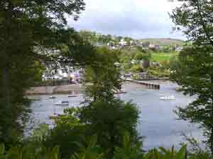
 | spectacular views of the river Dart |
A lovely country walk through an ancient landscape with spectacular views of the river Dart.
The Walk
A As you exit the car park turn right into Ham Lane. Continue in land for miles . At T junction turn right then take steps on right down to Lower Street. Continue past church yard through a residential area until you reach Higher street.
Turn right. following the John Musgrave Trail.
B If the tide is low turn right across a small foot bridge then cross lane into a foot path else continue and take next bridge then take foot path on left.
C At East Cornworthy turn left into a lane ; continue and after crossing a bridge take the next lane right; this takes you past Old Coombe Mill.
At the next junction with fingerpost marked Barberry follow signs for Kingston ; do not turn off towards Kingston but continue along this green lane for 0.7 miles.
D Where the lane bends sharply to the left with track and footpath on right take the public footpath between hedges back towards Dittisham.
E Turn right into Higher Street. Continue past Post Office and  the Red Lion into The Level.
F After 0.2 miles turn left towards the Ferry.
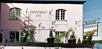
Follow path along the beach passing the Ferry Boat Inn back to the car park.
There are several climbs and descents.
Download Walk 1
| Download GPX | Mobile or GPS | |
| Download FIT | Watches | |
| Google Earth | ||

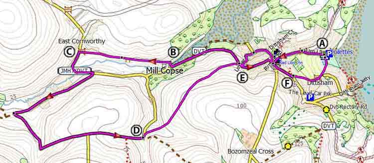
Map of Walk 1
| Walks near Dittisham | |
| Dartmouth | |
 | Dartmouth with its narrow streets and ye olde buildings offers the walker many places of interest including the Boat Float and Castle. |
| Cornworthy | |
 | Great pub walks through a most scenic landscape to the famous Malsters Arms atTuckenhay. |
| Totnes | |
 | Town Trail & Best Circular Pub Walks around Totnes and along the river Dart |
| Torcross | |
 | Great coastal walks from Torcross to Widdicome House,Beesands or the lost village of Hallsands - |
| Greenway | |
 | The tranquility and beauty of this estate gave Agatha Christie the inspiration for many a plot. Two varied and most scenic walks. |
Walk 2 Dittisham to Capton Mill (6.1 miles)
This delightful but strenuous 6 mile hike starts and ends like walk 1 but explores the rolling landscape surrounding Dittisham.
Difficulty:
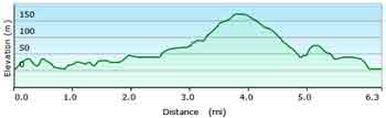
For more information on downloads of long distance hiking routes in Devon click here.
Download Walk 2
| Download GPX | Mobile or GPS | |
| Download FIT | Watches | |
| Google Earth | ||
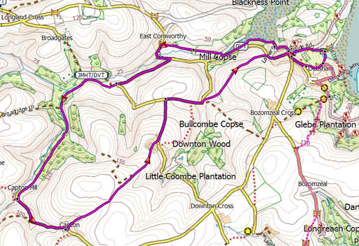
Map of Walk 2






Walk 3 Dittisham to Dartmouth (3.8 miles)
Difficulty:

This makes an ideal pub ; start either from Dartmouth or Dittisham.
The walks follows part of the Dart Valley Trail using lanes, public foot and bridle paths and some residential roads.
Download Walk 3
| Download GPX | Mobile or GPS | |
| Download FIT | Watches | |
| Google Earth | ||
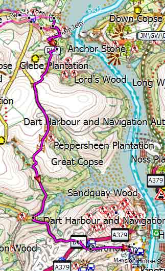
Map of Walk 3
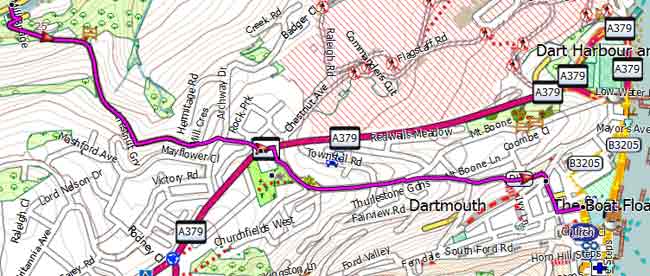
Dartmouth Stretch
