Best Great Torrington Walks
| Select Your Walk | Walk 1 (3.5 miles) | Walk 2 (3.9 miles) | Walk 3 (1.5 miles) |
| Torrington Common | Puffing Billy | Obelisk |

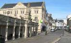
Great Torrington, second oldest Saxon market town in devon, makes an ideal centre for walking offering extensive views of a dramatically meandering Torridge.
- In 1642 Fairfax captured the Cavaliers and imprisoned them in the church of St Michael and All Angels (see below) . Unfortunately, a powder magazine , also kept in the church, exploded - killing all inside.
- The town suffered a large fire in 1742.
| What to explore? |
- Leper Colony (see below)
- Great Torrington Museum
- Dartington Glass Factory & tours
- Rosemoor Gardens
- Obelisk
| There are several pubs in Torrington | |
| South Street Pay & Display Car Park |
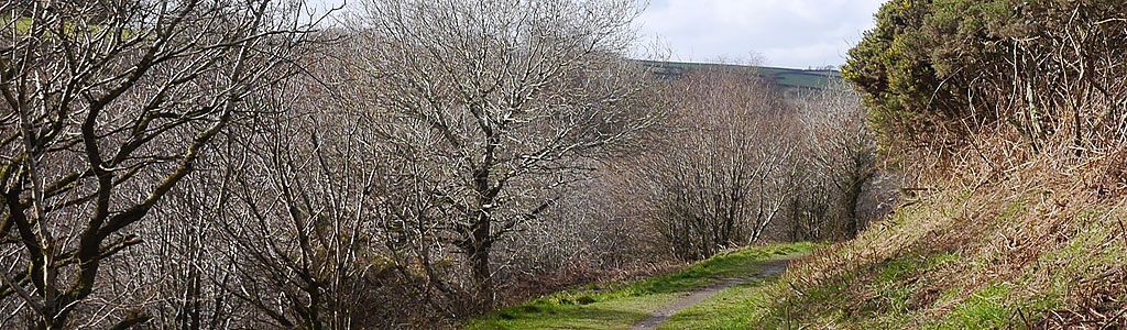
Walk 1 Torrington Common, river & Obelisk (3.5 miles)
Difficulty:![]()
Enjoy stunning views on this popular walk through Great Torrington Common, past the River Torridge, and the iconic obelisk.

Note:There are several steady climbs and descents.
The Walk
A The walk starts from Torrington's main Car Park. By the toilets turn right into South Street, then left into High street and continue past St Michael and All Angles Church crossing A386 into School Lane.
Continue for half a mile ignoring lane on right , then beyond the outskirts of the town turn left into a public footpath.
B Continue through the Common for a bit more than half a mile then turn left into another public footpath which zigzags uphill towards a small car park near a cemetery. Follow a service road to the main road.
C Turn left then almost immediately on the edge of the cemetery turn right into a tarmac footpath opposite. At the end take path diagonally cutting through wasteland .Near residential area into a small alley leading to Mill Street.
Next, turn right until main road then left. Before bridge turn left into a track next to a Toll House.
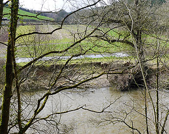
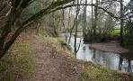
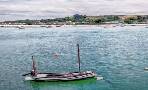
D Across the river lies Taddiport where during the 13th century lepers were housed - fields were set aside for them to cultivate but only two remain , see picture below.
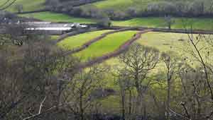
Continue taking path nearest to the river then after half a mile take a left path zigzagging uphill. Cross another path then up until next crossing of paths.
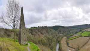
E Turn right then continue until the Obelisk which was built 1in 1818 to commemorate the battle of Waterloo (1815).
Turn left then climb steadily up hill to the car park.
A GPS is highly recommended.
Note:Free Parking available for this walk only - see below.
Download Route
| Download GPX | Mobile or GPS | |
| Download FIT | Watches | |
| Google Earth | ||

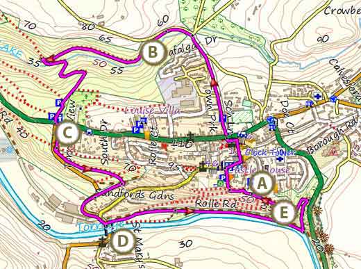
Map of Walk 1
| Walks near Great Torrington | |
| Hatherleigh | |
 | Explore a most tranquil saxon landscape. |
| Barnstaple | |
 | Two Best Walks with superb coastal views. |
| Bideford | |
 | Find out about Bideford's exciting past by following our Town Trail and enjoy a pub walk to Appledore. |
| Appledore | |
 | Great walks through a landscape designated as a Site of Special Scientific Interest. |
| Dolton | |
 | A great pub walk from Dolton to the famous Duke of York at Iddesleigh with links to Michael Morpergo and Rick Stein. |
Walk 2 to Puffing Billy(3.9 miles)
Difficulty:![]()
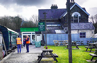
An equally pleasant walk across the Common to the old station and Puffing Billy.
It follows part of the Tarka Trail which you can download from here
Download Route
| Download GPX | Mobile or GPS | |
| Download FIT | Watches | |
| Google Earth | ||

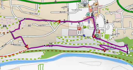
Map of Walk 2
Walk 3 to Obelisk(1.5 miles)
![]() Difficulty:
Difficulty:![]()
| Best Devon Town Trails |
This easy Town Walk to the obelisk includes a descent and a steady climb.
Start from South Street and walk West to the Torrington Methodist Church.
Follow path right of Church into Warren Lane.
After 160m turn left onto a path . Continue for another 150m then at the junction with another footpath turn left.
Continue South onto a service road.
At the junction with Mill Street turn left then soon take next footpath on right.
At the end of this path turn left onto another path and continue East.
Use map to guide you.
Map of Walk 3