Best Tipton St John Walks |
| Select Your Walk | Walk 1 (2.5 miles) | Walk 2 (4.6 miles) | Walk 3 (6.5 miles) | Walk 4 (3.8 miles) |
| Otter & Harpford | Otter & Beacon Hill | to Ottery St Mary | Newton Poppleford Orchard |

Tipton St John in the Domesday Book of 1086, was recorded as "Teppetone".
- "tæppa" in Old English means "a pointed piece of land" and "tun" implies a "settlement".
- It is difficult to imagine that the village was once home to a railway station on the Sidmouth Railway line, opened in 1897 and closed in 1967.
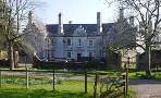
- Tipton boasts a pub , the Golden Lion, a school and a little shop.
Download GPX files and follow walk on your mobile !
| Walk 2 | |
| Golden Lion | |
| See for each walk | |
 | How to Follow GPX Routes on your mobile. |
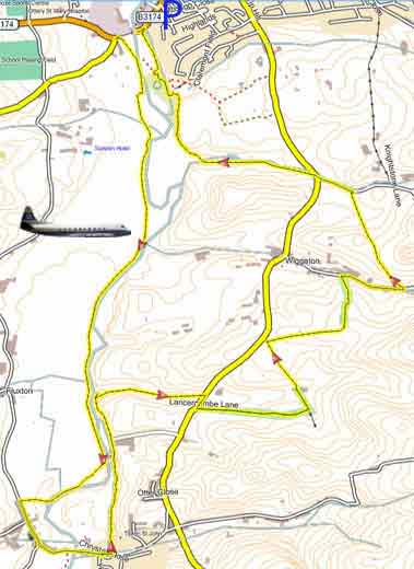
Walk 1 Otter & Harpford (2.5 miles)
Difficulty:![]()
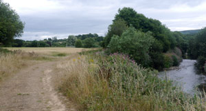
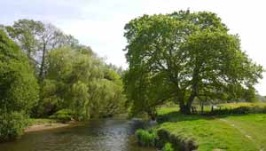
| Start : Bridge Across Otter |
A very pleasant and popular river walk along the Otter.
The Walk
A A short but very pleasant walk following a public footpath along the Otter towards Newton Poppleford.
B It crosses a footbridge and leads into the picturesque village of Harpford.
C The walk returns via a disused railway which used to run to Sidmouth.
| Village or Private Car Park with donation nr bridge |
| what3words ///twee.cartoons.planting |
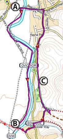
Map of Walk 1
| Walks near Tipton St John: | |
| Newton Poppleford | |
 | 3 TOP Walks ! |
| Ottery St Mary | |
 | This easy and varied walk crosses Knightstone estate - the private Manor is one of the best preserved medieval houses in Britain - and returns along the Otter. |
| Harpford | |
 | Delightful (pub) walks through Harpford Wood, a most dramatic and ancient wood containing unique fauna. |
| Coleridge Link | |
 | A delightful 9 mile walk following the route often taken by Coleridge. |
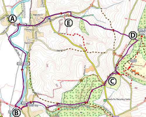
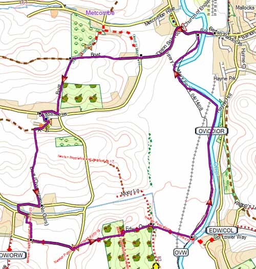
Walk 2 Otter & Beacon Hill (4.6 miles)
![]() Difficulty:
Difficulty:![]()
| Start :Bridge across Otter |
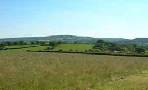
If you enjoy breathtaking views, this delightful and popular walk is perfect for you! It follows a route once favoured by the poet Samuel Coleridge.
The Walk
A Following the river Otter the route leads into Harpford via a footbridge.
B Follow the East Devon Way ((pink foxglove symbol)) into Harpford Wood and beyond.
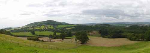
C Somewhat steeply ascends to Beacon Hill and Harpford Common where the views of the coast and Haldon are breathtaking.
D It continues along an old path and returns via a bridlepath.
E As you enter the outskirts of Tipton ensure you follow the bridle path to a country lane and not be tempted to negotiate a poorly maintained footpath.
Download Route
| Download GPX | Mobile or GPS | |
| Download FIT | Watches | |
| Google Earth | ||
| Stunning views - Bring camera |
Map of Walk 2
length: | 4.6 miles |
time: | 2 hr 10 mins |
terrain: | tracks bridle/ footpaths |
| country lanes | |
main roads | 0 % |
1% | |
altitude range | 28 - 224 m |
quality of track | *** |
stiles | several |
| download PDF |
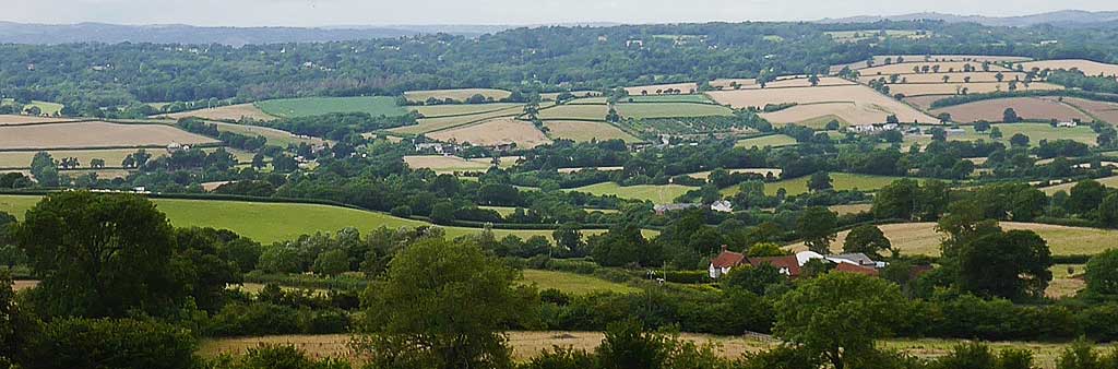
Walk 4 Newton Poppleford Orchard (3.8 miles)
Difficulty:![]()
Another favourite walk West of the Otter to Venn Ottery Church and a delightful orchard overlooking Newton Poppleford.
| Start : Bridge Across Otter |
Map of Walk 4