| Walk 1 (3.1 miles) | Walk 2 (3.6 miles) | Walk 3 (6.8 miles) |
| Slapton Sands to Slapton | Slapton Sands to Slapton | Slapton to Torcross |

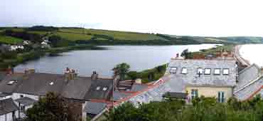
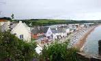
Slapton and Slapton Sands have long been a favourite tourist attraction.
All our walks start from Slapton Sands as parking in the village is problematic.
| Slapton Sands Memorial Slapton Ley Slapton Chantry College | |
| The Tower Inn and The Queens Arms (both in Slapton) | |
| Slapton Monument Car Park, Pay & Display, off A379 |
| SATNAV Postcode:TQ7 2TQ |
Walk 1 Slapton Sands to Slapton (3.1 miles)
Difficulty:![]()
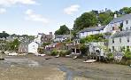
A picturesque village nestled between the scenic Slapton Ley Nature Reserve and beautiful Slapton Sands beach, ideal for nature lovers and history enthusiasts alike.
| spectacular views of Slapton Sands |
The Walk
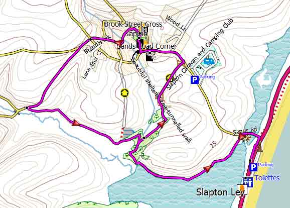
A This popular walk starts in Slapton Memorial Car Park.
| This walk crosses a busy road. |
Cross the busy road and turn right following part of the South West Coast Path until you come a lane to Slapton Village.
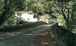
Continue along the lane until you have crossed a bridge then turn left into a footpath. This takes you along Slapton Ley, a large natural freshwater lake.
B Continue along Slapton Ley following footpath and after 0.6 miles ignore a public footpath on left but continue until reaching a lane
C Turn left then continue for 0.2 miles then after Slapton Village Shop turn right into Prospect Hill. This takes you past both pubs.
D Behind the Tower Inn pub are the tower ruins of what once was a Chantry College.dating back to the 14th century.
Turn left into Brook street . At the crossroads continue in the direction of a public footpath sign.
The lane turns into a footpath. Continue through a wooded area until you reach another footpath.
Turn right and return the way you came.

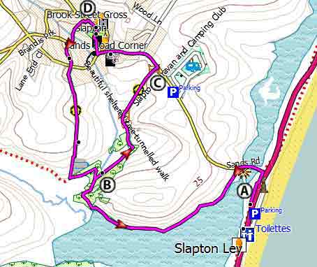
Map of Walk 1
| Walks near Slapton | |
| Noss Mayo | |
 | Two Best Walks with superb coastal views. |
| Loddiswell | |
 | Best walks through the Avon valley. |
| Torcross | |
 | Great coastal walks from Torcross to Widdicombe House, Beesands or the lost village of Hallsands - |
Download Route
| Download GPX | Mobile or GPS | |
| Download FIT | Watches | |
| Google Earth | ||

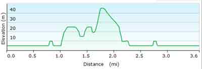
Walk 2 Slapton Sands to Slapton (3.6 miles)
Difficulty:![]()
Similar to the first walk but slightly longer and more varied.
Download Route
| Download GPX | Mobile or GPS | |
| Download FIT | Watches | |
| Google Earth | ||
Map of Walk 2
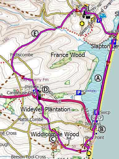
Walk 3 Slapton to Torcross (6.8 miles)
Difficulty:![]()
This invigorating pub walk takes you to Torcross along Slapton Sands.
It returns via Widdicombe House, Stokenham village with its 15th century church, Slapton Castle and Slapton.
The Walk
A From the car park cross the road and turn left following the South West Coast Path.
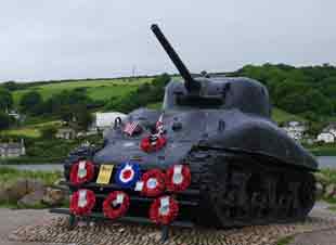
In April 1944 this stretch was used for the ill fated Exercise Tiger - a lot had to be hushed up due to the D Day preparations.
The path to Torcross is 1.4 miles long and requires a great deal of stamina following a straight line for over 30 minutes through an exposed landscape that barely changes!
B However , Torcross provides ample opportunities for refreshments!
CWiddicombe House , used by Eisenhower as his headquarters.
D![]() Pubs in Stokenham:
Pubs in Stokenham:
Church House Inn
The Tradesman Arms
E Not much remains of Slapton Castle , an Iron Age hill fort.
Download Route
| Download GPX | Mobile or GPS | |
| Download FIT | Watches | |
| Google Earth | ||
Map of Walk 3