| Select Your Walk | Walk 1 (4.1 m) | Walk 2 (5.7 m) | Walk 3 (3.8 m) |
| Fingle Bridge Best Route | Fingle Bridge & Cranbrook Castle | Fingle Bridge Quiet Route |
Three delightful walks near Drewsteignton ideal any time of the year!
Archaeological evidence suggests that the area around Drewsteignton was inhabited during the Neolithic and Bronze Age periods, with evidence of settlements and burial sites from these times still visible today. The village itself dates back to the Saxon period, when it was known as "Drewe's Stead" (Drewe's Place) after the Saxon landowner who lived there.
During the Middle Ages, Drewsteignton was an important center for wool production and trading, and the village grew in size and importance. The Church of St James, which still stands today, was built during this time and became an important religious and cultural center for the village.
In the 16th and 17th centuries, Drewsteignton became a center for the tin mining industry, which brought wealth and prosperity to the village.
| Walks near Drewsteignton: | |
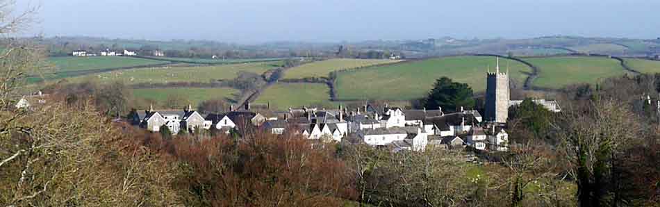
| Chagford. | |
 | Superb walks from this bustling Market town exploring the stunning beauty of this part of Dartmoor. |
| Moretonhampstead | |
 | Moretonhamstead , gateway to Dartmoor, is an ideal town for walkers to explore the lush edge of the moor. |
| South Zeal | |
 | Two popular pub walks exploring North Dartmoor |
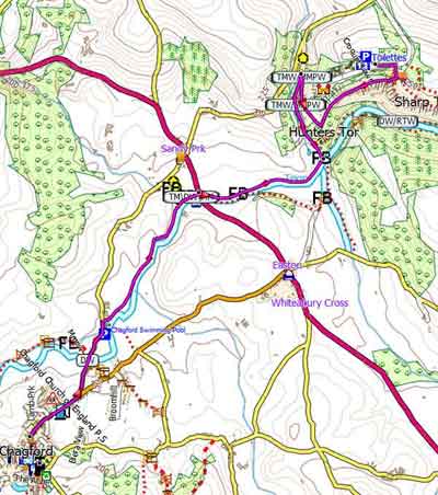
| Drewsteignton Fingle Bridge Castle Drogo |
| Free Car Park in Village |
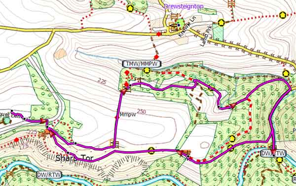
Walk 1 Fingle Bridge (2.6 miles)
Difficulty:![]()
A pub walk through one of the most magical landscapes in Devon!
Caution:There is a steepish descent near Fingle Bridge .
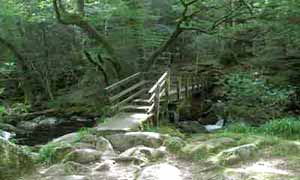
Follow the famous Hunters' Path and return at Fingle Bridge via a riverside path, Fisherman's Path.
Note:this public path is rocky in parts and can be quite slippery.
A hundred years ago Black wrote :
'Thus one mounts to the Hunter's Path along the top of the gorge, on this side heather clad and crowned with firs, while the other is mantled with the copsewood of Whyddon Park...The windings of the river make a fine sight from the upper path, on which comes a reputed logan - stone. After following this for a mile one comes into sight of the lonely bridge'
Has anything changed?
ROUTES
Download FIT for Watches / GPS
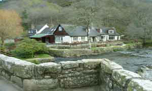
 | En Route All walks pass Fingle Bridge Inn. |

Walk 1
Walk 2 Teign Gorge ( 5.9 or 7 miles)
Difficulty:![]()
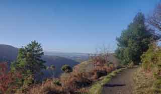
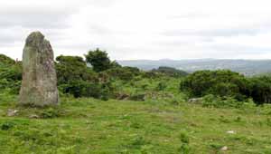
A longer, varied, more strenuous but equally rewarding walk to Cranbrook Castle, an Iron Age hill fort, with it's magnificent panoramic views of Dartmoor and Castle Drogo.
Add an extra mile to include Castle Drogo making it 7 miles.
There is a steepish climb at Fingle Bridge - see below.
| How to use a GPX / FIT file | ||

Walk 2
time: | 2 hr 50 mins |
terrain: | tracks bridle/ paths |
| lanes | |
main roads | 0 % |
yes | |
altitude range | 105 - 334 m |
quality of track | *** |
stiles | several |
| FIT Route for Watches / GPS | |
Walk 3 towards Drewsteignton (3.8 miles) without the crowds
Difficulty:![]()
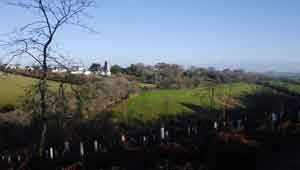
A quieter route through ancient woods & with spectacular views of Drewsteighton.also leads to Fingle Bridge and its Inn.
Download FIT for Watches / Mobile
Walk 3
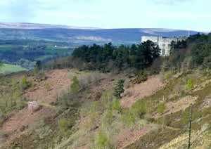
Walk 4 Chagford to Drogo and back (6.6 miles)
| Difficulty |
A great river walk from Chagford to Castle Drogo or vice versa.
![]() Fingle Bridge Inn at Fingle Bridge
Fingle Bridge Inn at Fingle Bridge