| Best Devon Walks |
| Best Devon Walks |
| Best Ide Walks |
| 4 TOP Walks |
|
| Ide Ford College Block |
| Walk 1 | Around Ide |
| 1.2 miles (30 mins) | |
| Walk 2 | Abandoned Railway |
| 1.7 miles (50 mins) | |
| Walk 3 | Ide to Alphington circular |
| 4.2 miles (1h 50) | |
| Walk 4 | Old Ide circular |
| Nearby |
All walks from Ide involve a certain amount of climbing and descending.
| Longest ford in England Ide abandoned railway line & Halt | |
| The Huntsman | |
| Free Ide Car Park,nr roundabout |
| Walk 1 Around Ide (1.2 miles) |  | |
| MAP |
Difficulty:![]()
This delightful short walk has become possible since the recent creation of a permissive path which joins two lanes.
You can combine walk 1 and 2. At F continue along lane and at T junction turn right to the carpark. From here follow Walk 2.
Note: the walk includes 2 styles and a steep descent.
The Walk
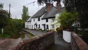
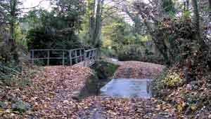
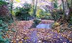
A Start at The Huntsman Inn. Take path to right of pub along the longest ford then continue along a quiet lane climbing steadily.
B At top of Hill take permissive path on left and continue along the hedge which follows the lane.
C Where you see another entrance and stile turn left and descend keeping hedge on right - this is quite steep in places.
D At the bottom of the hill continue through gap and follow path on left which skirts a stream.
E Where it joins a lane turn left and head towards Ide.
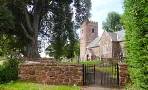
F Just before the church take public footpath on left .At the back of the church keep left and continue along a paved path through a housing estate, Continue until you reach High Street. Turn left ,back towards the pub.
Download route for Mobile / GPS
| Walk 2 Abandoned Railway (1.7 miles) |  | |
| MAP |
Difficulty:![]()
| Abandoned railway to Christow |
Follow a footpath next the car park to a stile; then join the abandoned railway track which used to lead to Alphington. You'll soon notice a footpath on your right; follow this and when you enter a field always keep to close to the hedge on your left until you reach the top of a steep hill.
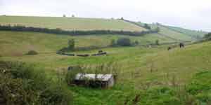
From here you will have great views of Devon's rolling hills and the city of Exeter. It is not a coincidence that nearby a Roman signal station has been found.
As you descend, you can still see part of what would have been the old railway bridge.
For more information on the old Ide line click here.
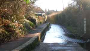
Near the WW1 memorial, either fork left to return to Ide or turn right & for a short while follow the pavement along the main road ,then turn left into a public footpath leading to the longest ford in England!
Which ever way, you will be passing the ![]() Hunts man pub and perhaps investigate for some refreshments.
Hunts man pub and perhaps investigate for some refreshments.
Continue up the hill then just before the school, turn into a path on your right which eventually takes you to Ide's church
Download route for Mobile / GPS
| Walk 3 Ide to Alphington circular (4.2 miles) |  | |
| MAP |
Difficulty:![]()
For more information on this most popular walk click here
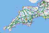 |
| FREE SOUTH WEST HIKING MAP |
|
| Walk 4 Old Ide circular |  | |
| MAP |
Difficulty:![]()
A delightfully short walk exploring the unspoiled Alphington Brook Valley.
| Walks near Ide | |
 | |
| Alphington | |
 | |
| Shillingford | |
| (©) Pinns UK |