Best Dunster Walks | Walking through history |
| Select Your Walk | Walk 1 (4.5 miles) | Walk 2 (4 miles) | |
| Bat's Castle | Old Deer Park |
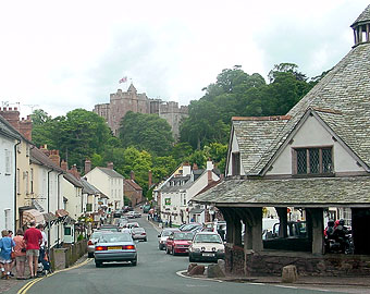
The historic & picturesque village of Dunster on the edge of Exmoor & the Quantocks makes an ideal centre for walkers.
Name means Dun's Tor (rock) .
| Pay & Display, Dunster Steep |
| SATNAV Postcode:TA24 6AS |
| What to explore? |
- Dunster Castle dating back to 11th century
- Dunster Tithe Barn (14th century)
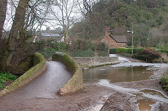
- Gallox Bridge (13th century)
- Deer Park (13th century)
- Bat's Castle (Iron age hill fort)
| Foresters Arms, The Stags Head Inn | |
| Coastline | |
| More Exmoor Walks |
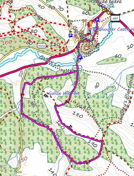
Walk 1 Dunster to Bat's Castle (4.5 miles)
A delightful woodland walk which takes in Bat's Castle, an iton age hill fort, and an old deer park.
Difficulty:![]()
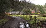
From the car park take the footpath to the village and into Castle Hill. Turn left into West Street then first left into Mill Lane.
Crossing the river Avil using Gallox Bridge, a medieval pack-horse bridge.
It is hard to imagine that once the people of Dunsford villagers could sail their small boats into the Bristol Channel!
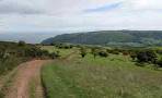
The walk enters the old Dunster deer park at Park Gate and turns right into a bridle path through Gallox Wood .
Continue until you reach a country lane; turn left then left again along a stream.
At Withycombe Gate turn left joining the Macmillan Way West . This trail cuts through Bat's Castle , an impressive old Iron-age settlement which later may have been occupied by the Romans - Roman artifacts were found along the coast road nearby.
After 0.3 of a mile turn right, following the Mac Millan West trail to descend back into Dunster.
length: | 4.5 miles |
time: | 2 hr |
Download GPX route for Mobile & GPS
Download FIT route for Watch & GPS

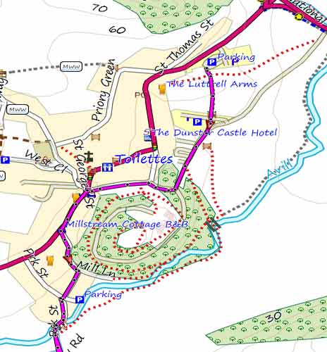
Walk 2 Dunster to Old Deer Park (4.0 miles)
Difficulty:![]()
This popular walk takes you past Gallox Hill Fort and Bat's Castle then returns via an old Deer Park.
Download GPX route for Mobile & GPS
Download FIT route for Watch & GPS
| How to view a route on your mobile |
| Dunster Village Pay & Display Car Park |
FREE 2021 HIKING MAP of South West
- More up to date than OS maps
- Designed for Walkers & Hikers
- PRINT YOUR OWN WALK IN DEVON!
No Login or Membership required!
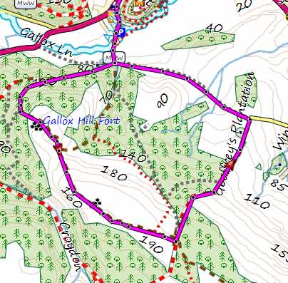
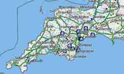
Map of Walk 2