
How to get OSVector maps on your Garmin
There is an 'official' way - see Using OS Shapefiles. However,for those not familiar with scripts, you can use Windows GUIs.
 |
1) Request from OS a download of the region you require - this takes up to 10 mins depending on the region.
2) Download qGIS to install the shp files as layers.
3) Convert each layer to WGS84, ie into Garmin friendly degrees.
Using qGIS, go : Vector --> Data Management Tools --> Export to new projection and select WGS84.
Save each layer as a new shp file.
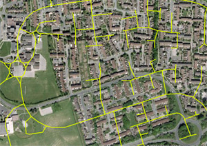
At this stage, all coordinates though converted, are badly shifted when projected onto Google Earth or uploaded to your GPS - see below.
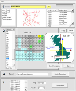
You can skip 2 & 3 by importing the shp file into GPSMapEdit. For the CIS select the 'British National grid' option. Save result as a mp file.
4) However,despite the conversion to WGS84 , all coordinates are still badly shifted . Each region has to be' tweaked' by a different factor. Osv2img enables you to apply the necessary correction to all coordinates for every region and tile.
The program, a shp2mp converter , uses Google Earth to fine-tune any correction producing mp/img files which project more accurately onto OSM .
 |
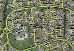 |
| Obvious misalignment | shp file corrected |
For a more detailed description download the manual:
Download OSV2IMG (Beta 0.3) > ( Google Earth required)
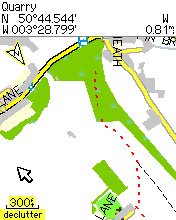 |
| Result: Buildings plotted on top of OSM map |