IMG2TYP5 & TYPWiz7
Create a TYP file for any Garmin Map.
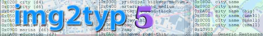
 |
| Part of TOPO France V3 showing Polygon & POI type numbers |
| Polygon draworders have been set to zero using TYPWiz 7 |
| In this picture Lines are not included in the TYP file |
No TYP file?
.
|
| More info on extra pois Info on latest POI TYPE numbers |
|
| See Tutorial on Youtube | |
Download IMG2TYP manual |
Examples
 |
 |
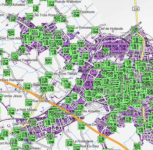
| NT Belgium without TYP file | NT Belgium with new TYP file |
 |
 |
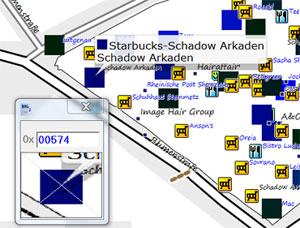
| Color Picker shows ID 0 x 0525 as Starbucks Default CN Europe 2015 does NOT show this icon |
Extra POI 525 with Starbucks Logo edited in TYPWiz 7 |