| Walk 1 (6.8 miles) | Walk 2 (3 miles) | Walk 3 (7 miles) |
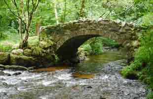
| Parke to Lustleigh | Packhorse Bridge | Manaton |
Three dramatic walks on the edge of Dartmoor.
'Leigh' means wood.
'Lust' refers to a name, possibly Leofgiest.
| Lustleigh Village Packhorse bridge | ||
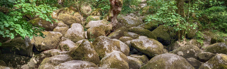
| The Cleave, Lustleigh | ||
| The Primrose Tea Room | ||
| Lustleigh village limited (nr church ) what3words | ||
| Parke (National Trust nr Bovey Tracey) what3words |
| Postcode TQ13 9TA |
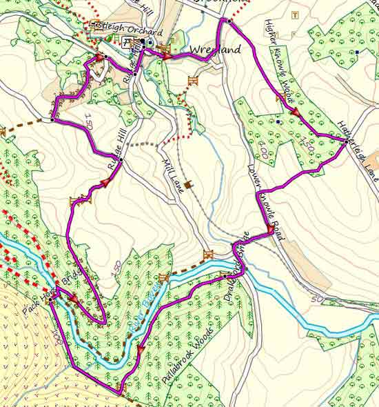
Walk 1 Parke - Lustleigh (6.8 miles)
![]() Difficulty:
Difficulty:![]()
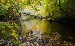
This delightful walk takes you into a most unspoilt and dramatic part of Devon following the river Bovey.
Parking in Lustleigh is very limited - there being no official car park. You may find some spaces near the church and along Lower Knowle Road.
We therefore recommend you start at Parke (charges apply) and walk to the picturesque village of Lustleigh.
The Walk
AParke now belongs to the National Trust covering 250 acres of parkland .Home Farm Cafe opens from 10 am.
BThe route runs parallel to lane following a well defined path.
C Site of Pullabrook Halt on the abandoned railway line to Moretonhampstead.
D At an old Packhorse bridge wide enough for one horse with sidebags , turn right into a public footpath. There follows a steep climb into Lustleigh.
E In Lustleigh you can enjoy refreshments at ![]() the Cleave or
the Cleave or ![]() the Primrose Tea Room before returning.
the Primrose Tea Room before returning.
The route follows a bridle path past the cricket grounds then joins a lane. Turn left towards Brookfield.
F At the junction with postbox turn right into a lane which soon changes into a footpath. Continue through Higham Knowle Wood then onto a lane .Where this lane splits take right fork.
G The old railway bridge. Take footpath into Parke.
H A pleasant stroll along the river Bovey.

There are some steep climbs.
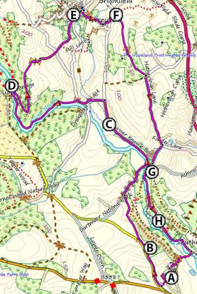
Map of Parke to Lustleigh Walk (6.8 miles)
| Walk 1 | |
length: | 6.8 miles |
time: | 3 hrs |
terrain: | tracks bridle/ paths |
| lanes | |
main roads | 0 % |
2% | |
altitude range | 34- 166 m |
quality of track | *** |
| FIT for some Mobile / GPS devices | |
| Show on Google Earth | |
| Walks near Lustleigh | |
| Bovey Tracey | |
 | This popular and fairly easy walk follows well maintained footpaths through the beautiful Parke estate, near Bovey Tracey, now belonging to the National Trust. |
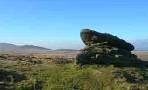
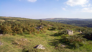
| Haytor | |
 | There is much more to Haytor than a steep climb to the Tor and back again! Two very popular and fairly easy walks in search of a lost village. |
| Moretonhampstead | |
 | Moretonhamstead , gateway to Dartmoor, is an ideal town for walkers to explore the lush edge of the moor |
| Dartmoor Walks | |
 | Carefully selected walks with easy car access! |
Walk 2 Lustleigh to Packhorse Bridge (3 miles)
Difficulty:![]()
A very pleasant walk starting from the village and descending to the famous packhorse bridge.
It follows mainly public footpaths or quiet lanes.
Walk 2 FIT for some Mobile / GPS devices
Map of Walk to Packhorse Bridge(3 miles)
Walk 3 Manaton (7 miles)
Difficulty:![]()
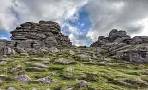
An invigorating but most enjoyable walk from Lustleigh to Manaton & Hunter's Tor.
| Lustleigh village or Parke (National Trust nr Bovey Tracey |
Limited Parking:Knowle Road or village
If only they had a gps in 1894?

Map of Manaton Walk (7 miles)